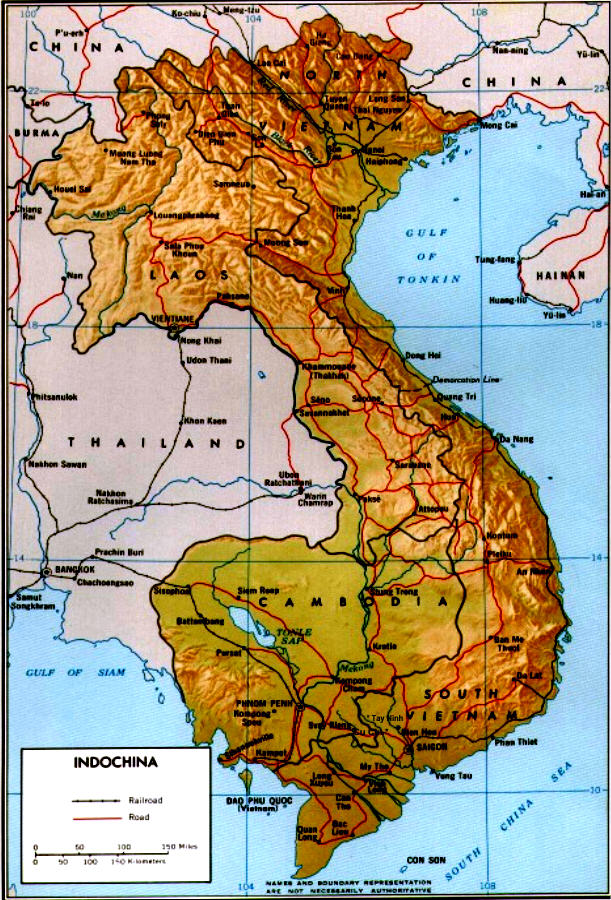
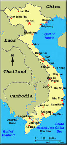
General map showing Indochina with location of the larger cities in North and South Vietnam
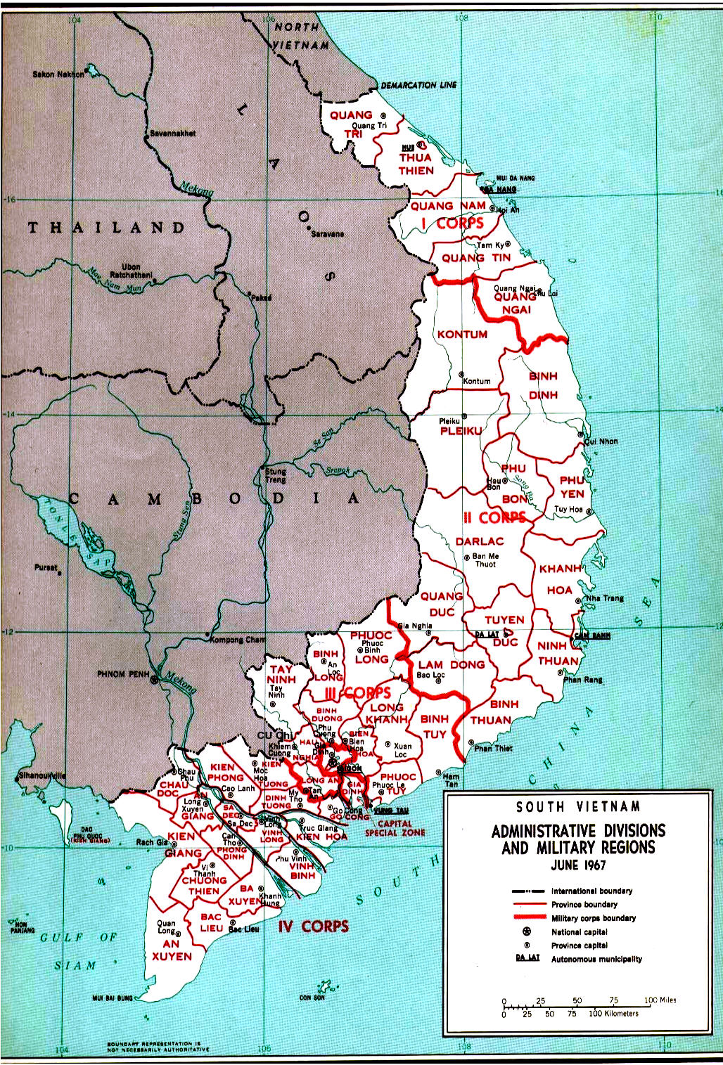
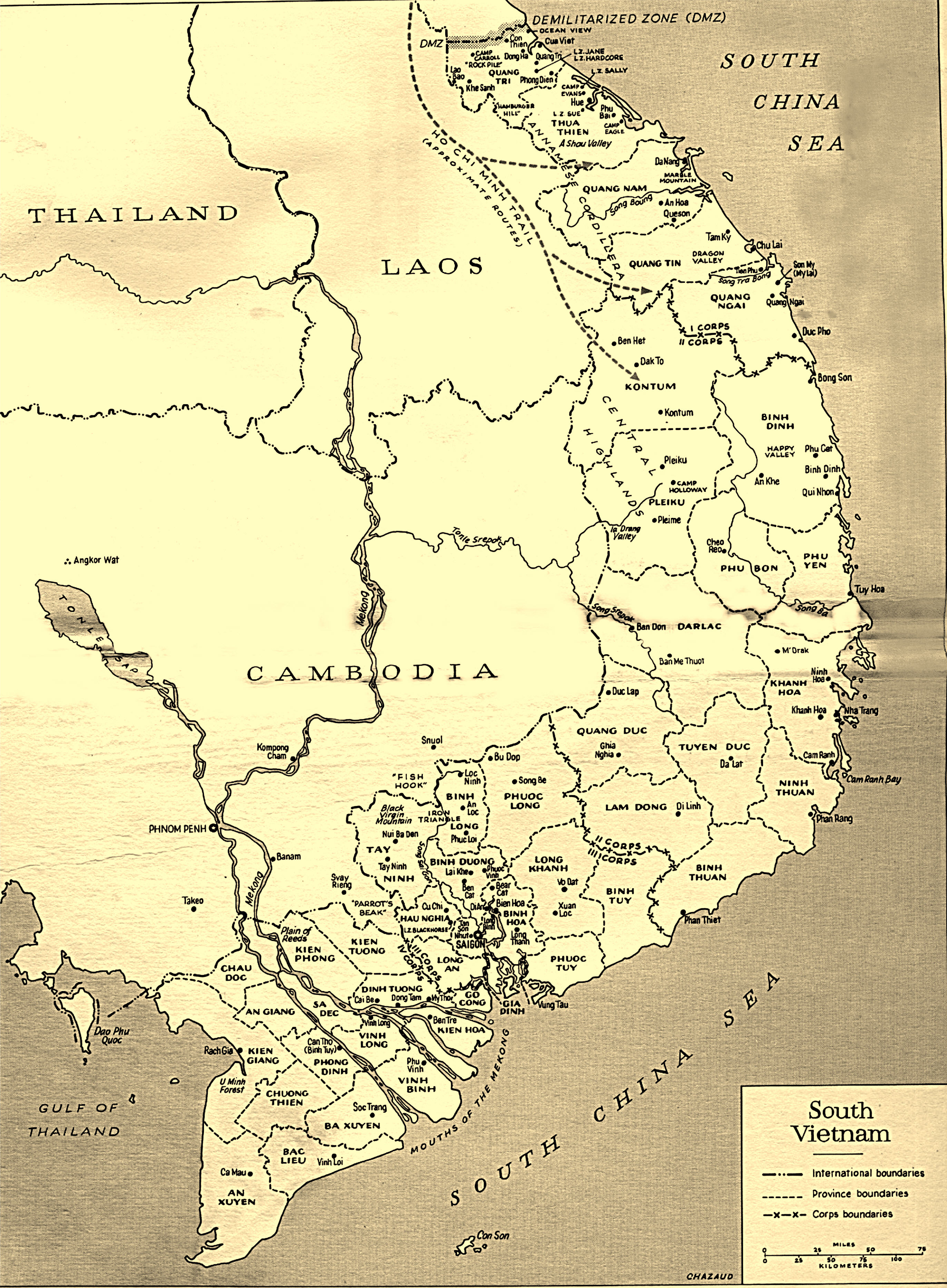
An excellent map of South Vietnam showing the Provinces their Capital Cities and Rivers circa 1967
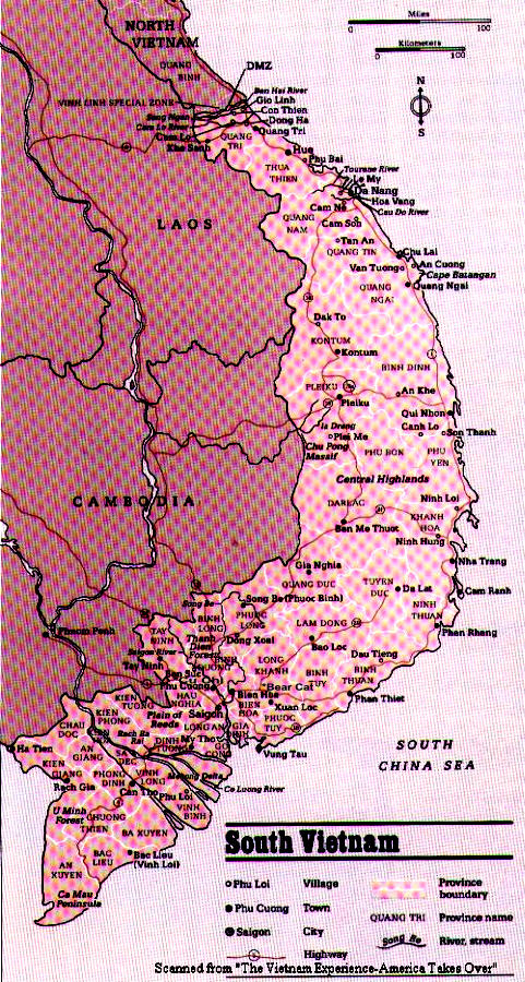
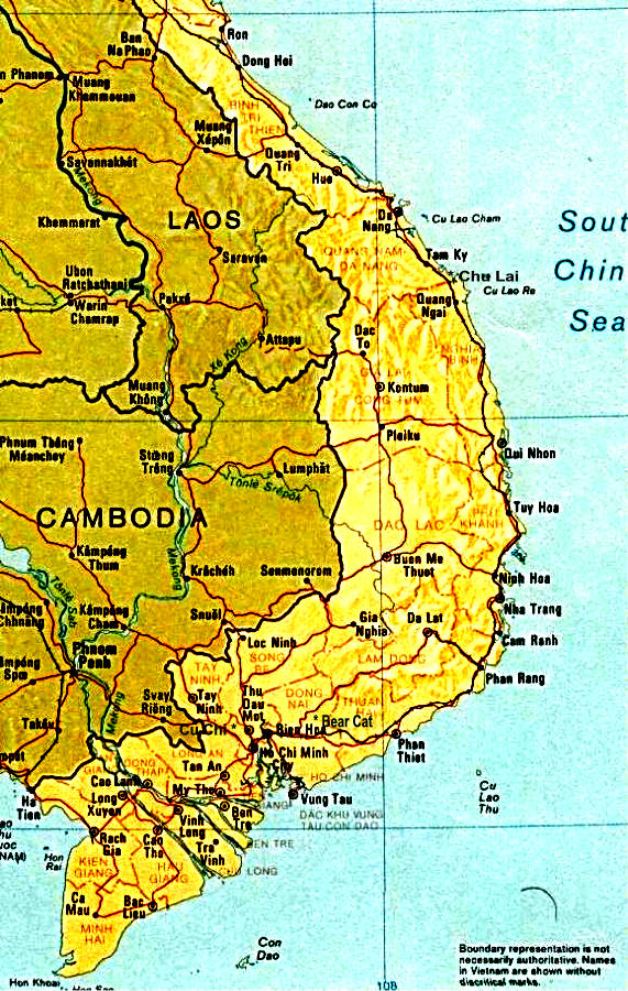
Map of South Vietnam showing various Provinces and cities circa 1967
Map of South Vietnam showing various Provinces and cities circa 1967
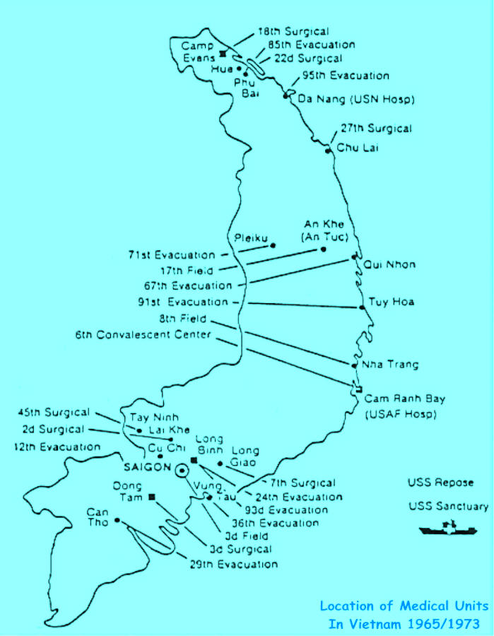
A unique map showing the location of the medical units and hospital ships that helped save many lives in Vietnam
"Click on photos to enlarge"
We have tried to present the most accurate of information. If you find discrepancies or dead links, please contact the Webmaster
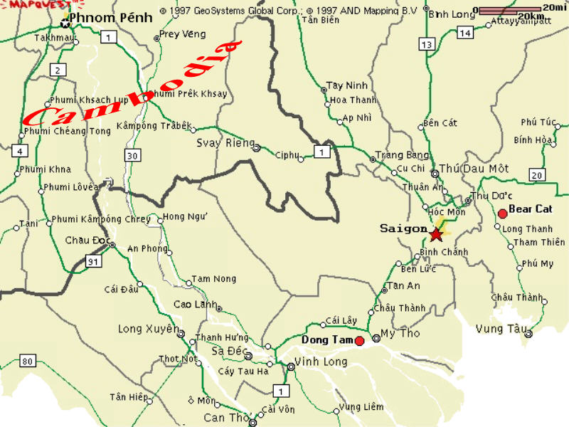
A good detailed map of the Saigon Region. In relation to this site, it shows the operating area of the 196th Infantry, the 199th Infantry, the 9th Infantry Division, 25th Infantry Division, and partial areas of the 101st Airborne, 1st Infantry Division and 1st Air Cav.
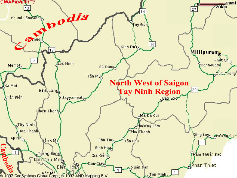
A good detailed map of the Tay Ninh area. This was the operation area of the same units listed in the Saigon Area Map
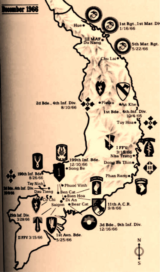
A unique map showing the location of the military units serving in Vietnam in December 1966
"Click photos to enlarge"
"Click photos to enlarge"
"Click photos to enlarge"
"Click photos to enlarge"
Looking for maps not shown here, try these map room links below.